County Monaghan Homeland - Aerial Views of Townlands



View: Rossnaglogh around Corravilla. Click to Enlarge.

View: Corravilla aerial map. Click to Enlarge.
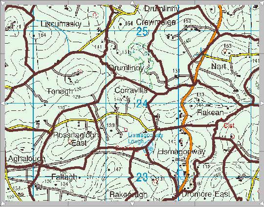
View: County Monaghan Planning Map. Click to Enlarge.

Closer View of Corravilla. Click to Enlarge.
What did this land look like? From satellite photos it appears this land has remained unchanged from what it looked like 160 years ago. The buildings may be newer and there are fewer dwellings today; however, the layout of the land looks similar to what was mapped out many years ago.
**********************************
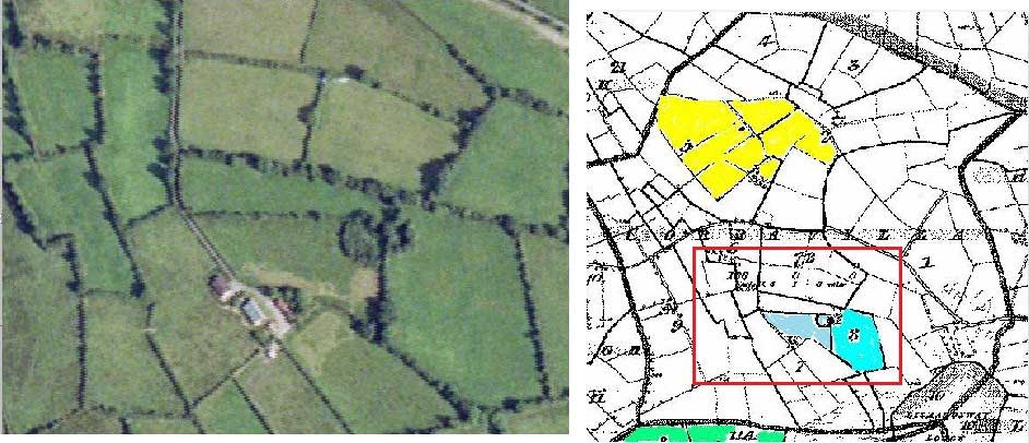
Corravilla Map and Aerial View - This map
shows how the lay of the land has remained unchanged through the years.
Corravilla Townland is adjacent to East Rossnaglogh Townland in Aghabog
Civil Parish in County Monaghan. The aerial map is compared against an
ordnance map created in the early to mid 1800's. The blue shaded area is
land once leased by William and Mary Smyth. Their daughter, Mary Smyth,
later married Michael McPhillips. Mary and Michael McPhillips' first
child, Susan, was also born in Corravilla. Susan McPhillips later
married "Irish" John Smith (Smyth) in Keyesville, Wisconsin, USA.
County Monaghan Planning Map - Newer map
showing various townlands in County Monaghan. These townlands would have
been well known to our Smyth, Greenan and McPhillips ancestors.
Milltown aerial view and map - Milltown Townland is located in
Ematris Civil Parish, County Monaghan, which is just south of Aghabog
Civil Parish. Milltown perhaps is just a couple miles south of East
Rossnaglogh Townland, where "Irish" John was born and lived. The
ordnance map was created in the early to mid 1800's and the landscape
remains mostly unchanged. In earlier times there would have been more
shanties. The areas shaded in blue were leased by Edward Greenan. Edward
and "Irish" John Smith were close relatives.
More maps - Rossnaglogh Corravilla Faltagh
- East Rossnaglogh Townland is 125 acres and Corravilla Townland is 168
acres. The area shaded in blue is where "Irish" John Smith was born and
lived. The area shaded in red is where our Smyth/McPhillips ancestors
lived. Both families lived in close proximity and is very likely they
knew each other in Ireland. Townland borders are shown in 'brown'. The
southern Townland, Faltagh, means 'Wall' and was leased by other Smyth
families. There are 640 acres in a square mile.
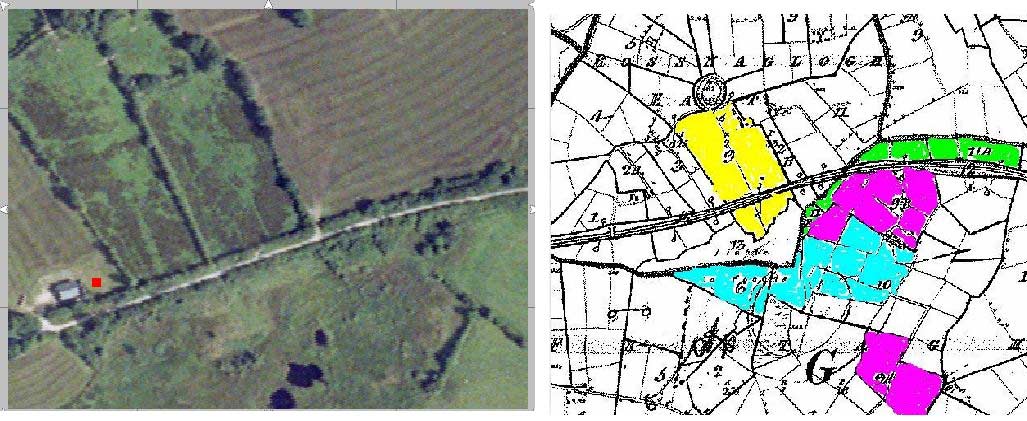
Smyths of Rossnaglogh map and aerial view -
Compare the old ordnance map with the aerial view. The area highlighted
in yellow is where Irish John was born and lived. The land layout
remained almost unchanged through the years. Of course, the buildings
shown on the map no longer exist.
Urcher aerial view and map - Urcher
Townland is located Kilmore Civil Parish, County Monaghan. Urcher is a
short distance east of Corravilla Townland in adjacent Aghabog Civil
Parish. "Irish" John Smith visited Greenan cousins in Urcher. One was
named Terry Greenan. In the mid-1800's the ordnance survey showed Terry
Greenan living in section 10; however, that would have been a different
Terry Greenan. The earliest Terry Greenan we believe eventually moved to
Wisconsin. The blue highlighted area was leased by Catharine Smyth. Was
this Irish John's mom? The upper portion of this map (section 2) shows
it was leased at one time by Michael McPhillips.
View: Smyths of Rossnaglogh map and1a.jpg

View: Urcher aerial view and map combination. Click to Enlarge.
View: Corravilla Map and Aerial View. Click to Enlarge.