

The Campbells of Tipperary
The Campbells of South Tipperary
Tipperary South (Tiobraid Arann Theas in Irish) is also known as Tipperary South Riding. It is an administrative county in the Republic of Ireland, consisting of 52% of the land area which constituted the historical county of Tipperary. South Tipperary was established in 1898 and has its own county council. The main town is Clonmel. Other important centers include Carrick-on-Suir, Cashel, Cahir, and Tipperary Town. We also find several Campbell surnames living in this part of Ireland during the mid-nineteenth century.
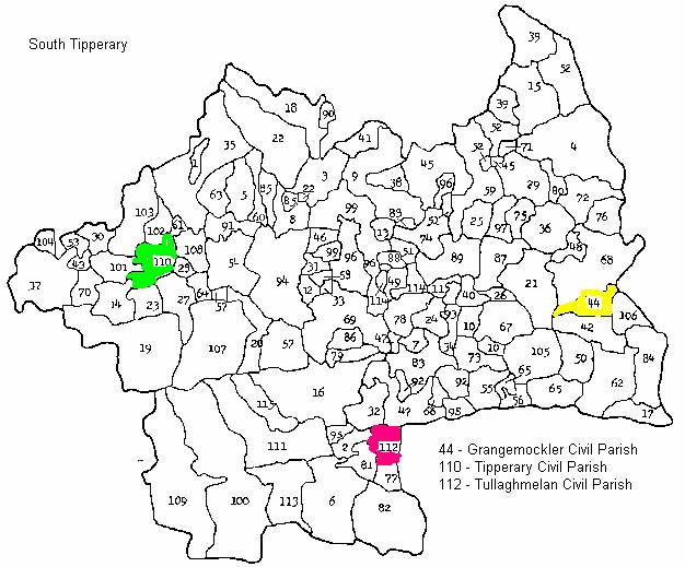
Grangemockler Civil Parish, Glennaskagh Townland
The following was taken from Lewis’s Topographic Dictionary of Ireland first published in 1837.
GRANGE-MOCKLER or NINE-MILE-HOUSE, a parish, in the barony of SLIEVARDAGH, county of TIPPERARY, and province of MUNSTER, 7 miles (S. by W.) from Callen (Co. Kilkenny), on the road to Clonmel; containing 666 inhabitants. Fairs are held here on March 25th, May 20th, Aug. 10th, Sept. 19th, Oct. 8th, Nov. 1st and Dec. 12th.
It is a rectory, in the diocese of Lismore, entirely impropriate in Caesar Sutton, Esq. The tithes amount to £80, and the impropriator allows £4 per annum to the rector of Kilvemnon for the performance of the occasional duties. In the Roman Catholic divisions it forms part of the union or district of Kilmurry, and has a chapel. There are three private schools, in which about 160 children are educated.
|
||||||||||||||||
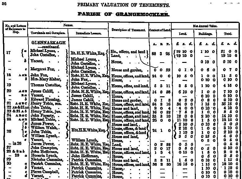 |
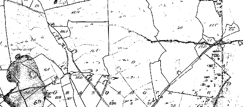
The following is the only map we could find of this area; however, it does not specifically show section 30, where Pierce Campbell lived.
We could not find any Tithe Applotment records for this area; however, we did find the 1766 Religious Census for this parish and environs. This is the only Campbell reference we could find from the same general area.
|
Name |
Religion |
Location |
|
James Campbell |
Protestant |
Fethard |
Tipperary Civil Parish, Bohercrow Townland, Town of Tipperary
The following was taken from Lewis’s Topographical Dictionary of Ireland, which was first published in 1837.
TIPPERARY, a market-town and a parish, in the barony of CLANWILLIAM, county of TIPPERARY, and province of banister, 18¼ miles (W. N.W.) from Clonmel, and 100¾ (S. W.) from Dublin city, on the mail coach road from Waterford to Limerick ; containing 7996 inhabitants, of which number, 6972 are in the town.
This place, which is of great antiquity, is supposed to have derived its name, ‘Tipra- Rae,’ signifying in the Irish language “the well of the plains,” and of which its present appellation is only a slight modification, from its situation at the base of the Slieve-na-muck hills, forming a portion of the Galtee mountains. A castle was erected here by King John for the defence of the territory acquired by the English, to which may be attributed the growth of the town, and the subsequent foundation of a monastery for Augustinian canons in the reign of Hen. III. contributed materially to its increase. The town, which gives name to the county, appears to have had formerly a corporation, from a grant made in 1310 by Edw. II. to “the Bailiffs and Good Men of Typerary," allowing them “murage” (as Adare) for three years. In 1329 the town was burnt by Breyn O'Breyn, but the monastery appears to have subsisted till the dissolution, when it was granted by Hen. VIII. to Dermot Ryan, at a yearly rent of eight pence.
The parish comprises 4263 statute acres, as applotted under the tithe act; the land is of excellent quality, and in a high state of cultivation; the system of agriculture t is improved, and there is no waste land. Limestone of good quality is quarried in the vicinity, and adjoining the quarry is also one of building stone.
The Roman Catholic parish is co-extensive with that of the Established Church : there is a small chapel in the town, which is about to be rebuilt on a larger scale ; also a place of worship for Wesleyan Methodists. About 400 children are taught in three public schools, of which two, one a classical school, are supported by the trustees of Erasmus Smith's charity ; and there are 16 private schools, in which are about 530 children, a dispensary attended by a resident physician and an apothecary, and a fever hospital.
|
||||||||||||||||
 |
||||||||||||||||
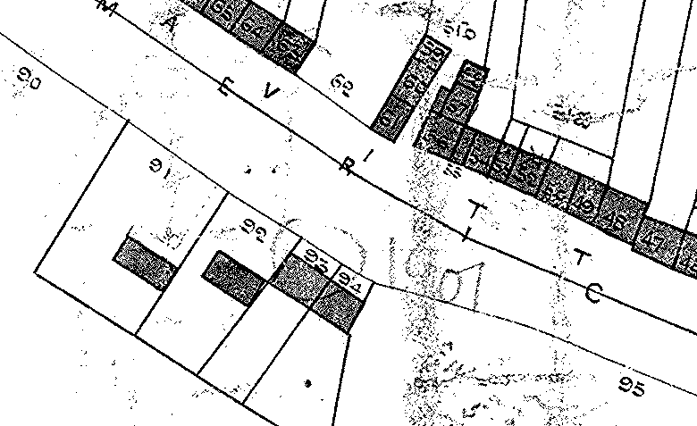 |
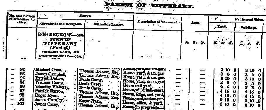
James Campbell lived on Limerick Road in the house identified by ’93’ on the map. His name was recorded in the Griffith Valuation Survey taken between the years 1847 and 1864.
It appears that several parishes intersected at Tipperary Town as the following information suggests.
Parish of Tipperary, Carrownreddy Townland, Town of Tipperary
The Griffith Valuation shows lease holders from the years 1847 to 1864. For Tipperary Town we find several names listed in the 1766 Religious Survey. There were no Catholic Campbells listed:
William Campbell Protestant
Robert Cambell Protestant
Patrick Campbell Protestant
The following information shows a Mary Campbell living in Carrownreddy Townland in the Town of Tipperary sometime during the period of 1847 to 1864.
|
||||||||||||||||
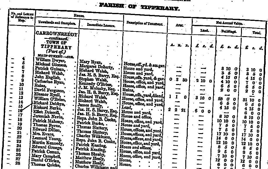 |
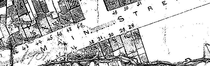
Mary Campbell lived in a house found on Main Street identified by ‘26’. This appears to be an older map as the map stops short at Section ‘28’. It is possible this house was built later than the date of this original map. At any rate, her record indicates this is the correct location where she lived.
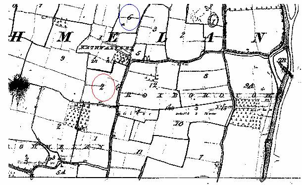
Parish of Tullaghmelan, Rathwalter and Roxborough Townlands
We combine both of these together as Rathwalter is very tiny, only 28 acres, and is located next door to Roxborough Townland. William and Lott Campbell lived in this area during the mid-nineteenth century.
|
||||||||||||||||
|
||||||||||||||||
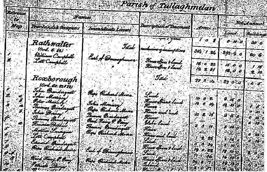 |
Circled in blue one finds the location where Lott Campbell lived. William Campbell lived in the area circled in red.
Finally
We will include additional information about this family as we find it.